calsfoundation@cals.org
Vanished: Mapping a Forgotten Era of Little Rock History
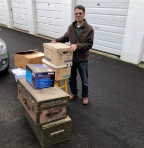
In 2019, Jim Conner of Little Rock donated a treasure trove of family material to the CALS Butler Center for Arkansas Studies. The family has been part of Little Rock’s history for over 150 years.

What came to be called the Keith-Conner family collection contains documents, photographs, and memorabilia relating to the Keith family of Little Rock and the Conner family of Little Rock and Augusta, Arkansas. The two families connected with the 1933 marriage of Delrena Clair Keith and Emerson Cornelius Conner. The collection includes substantial material related to James Keith, 1818-1908, and his grandson, also named James Keith, 1892-1954. (For clarity, the two men are referred to in the finding aid as James Keith I and James Keith II.) The collection includes substantial material from James Keith II’s service in the army during World War I, as well as business documents derived from his work as an officer of the Worthen Bank Company during the 1930s and 1940s.
During the course of processing the collection, Butler Center staff members discovered a photograph album that contained images of structures in downtown Little Rock from the 1920s to the 1940s. The album was apparently used as a documentary record of the family’s real estate holdings. Many of the buildings—mostly rental properties catering to lower- and middle-income citizens—were photographed for documentation.
One of the things that makes the photographs unique (and extremely useful) is that the backs of many of them contain detailed information such as when the property was sold, when it was renovated, and when it was torn down. This depth of information is uncommon.
After processing the collection, we decided that the album would make a great basis for an interactive mapping project. We had already done a couple of mapping projects utilizing the technology of Google Earth (Mapping Downtown Little Rock and Lost West Ninth Street), and this project seemed like another ideal candidate for that platform.
The first step in the process was scanning all the photographs to make digital versions. This took some time, as there are over 100 photographs in the album. The album is not in the best shape, so we had to carefully disassemble it to scan the photographs. Once the photographs were scanned, we reassembled the album.
The next step in the process was importing the digital photographs into Google Earth and plotting them on the map. In most cases this was easily done, as nearly all the photographs have addresses written on the backs. There were a few instances, though, where it was necessary to consult resources in the CALS Roberts Library research room such as city directories and Sanborn Fire Insurance maps to verify locations.

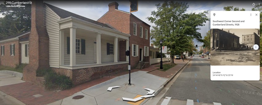
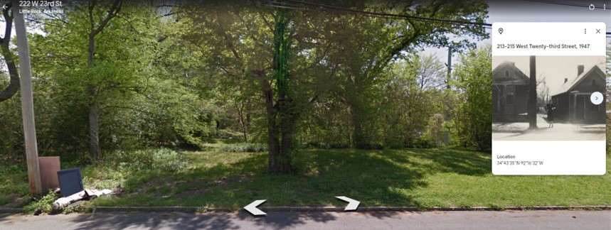
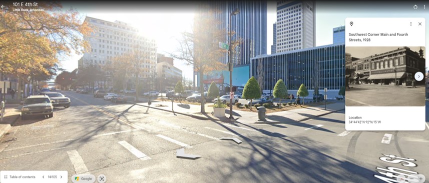
Once the photographs were in Google Earth, I had to orient the street views to match, as best as possible, the same angle as the historic photographs. This was sometimes a challenge, as the photographer usually took photographs from the sidewalk, whereas the Google Earth street view images are taken from an automobile.

When these historical photographs were combined with modern street views, it became clear how much Little Rock’s built environment has changed over the years. Nearly all the structures are long gone.

This project, Vanished: Documenting a Forgotten Era of Little Rock’s Built Environment, like our other mapping projects, has proven to be very popular. The donor of the collection, Jim Conner, was particularly pleased with how it turned out, saying in an email to me, “This is fabulous. What an extraordinarily valuable labor documenting the history of downtown Little Rock. A remarkable compilation. Thank you for my family and people interested in our city’s history. Historical architecture gives a vivid reflection of the time, and the comparison with photographs of the identical site today is the ideal format.”
View the project for yourself here. When viewing the project’s slideshow of just over 100 properties, be sure to click on the historical images so that you can make them larger and see more detail.
By Brian Robertson, manager of the Research Services Division at the CALS Butler Center for Arkansas Studies/Roberts Library


